Easedale Tarn

Easedale Tarn
With plenty of stone bridges for trolls to hide under, waterfalls plunging into pools, and a mountain tarn surrounded by an amphitheatre of fells, this walk is truly spectacular. For a family walk, it is quite long at about six-miles. It’s therefore best for children aged five and above, unless you are confident in your mini mountain goat’s walking abilities or are prepared for a bit of carrying. It is also not pushchair friendly and although fairly low level (reaching about 300m above sea level) there are some steeper sections. However, it is without a doubt, absolutely worth the effort.
The walk starts in Grasmere, taking you out of the village, through farmland, and then follows Easedale Beck and then the aptly named Sourmilk Gill up to Easedale Tarn. At this point, you can then choose to turn back the way you came for a slightly shorter (five miles) walk. However, for the more adventurous and those who prefer a circular route, you can descend through farmland on the other side of the waterfall and beck. This way of descent is quite boggy, and although there are plenty of stepping stones it is best avoided after heavy rain.
Quick Facts
Distance: 6 miles
Time: 4-5 hours with young children
Terrain: Mostly stepped, rocky paths
Suitable For: Children aged 5+, babies and toddlers in carriers, dogs must be kept on a lead due to grazing livestock
Parking: Plenty of pay and display car parks in the village of Grasmere
Facilities: Public toilets, shops, cafés, and bars and restaurants in Grasmere
The Start of the Walk
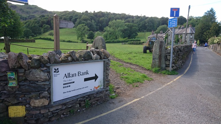
The Entrance to Allan Bank
This route starts at the entrance to Allan Bank. You can also start the route on Easedale Road, which is just a bit further down to the Allan Bank Entrance and signposted for Easedale Tarn. Both ways till lead you to the same point, but the Allan Bank way has less sections on the road. The entrance to Allan Bank is clearly signposted from the village, and is located where Langdale Road meets Broadgate, opposite The Inn at Grasmere and adjacent to the Miller Howe Café.
Passing Allan Bank

The Start of the Path
Follow the road from the village, and you will come to a cattle grid. Go over the cattle grid (there is a pedestrian section at the side) and you will now be on the main driveway up to Allan Bank. However, rather than follow this driveway, just after the cattle grid there is path on the right hand side, signposted for Goody Bridge. Take this path.
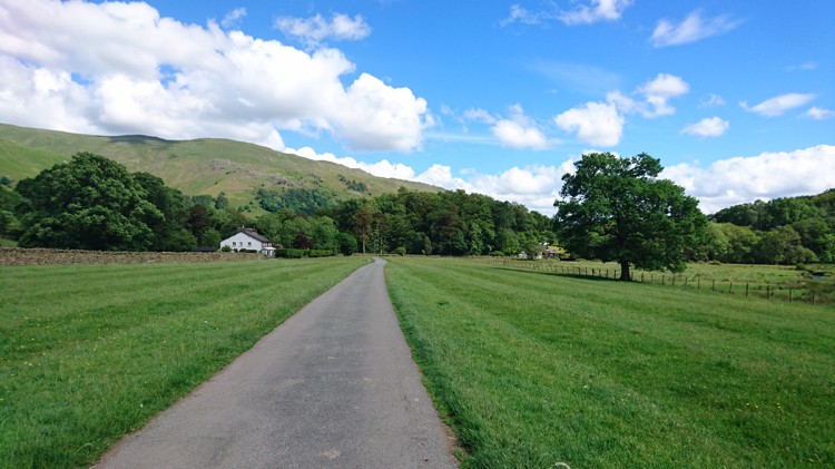
Through the Farmland

The Path and the Meadow
The path winds through farmland that is frequently used for grazing livestock. You will see a white house ahead, which is the Glenthorne Bed and Breakfast. The path leads to the left of the B&B and through a kissing gate. You will then find yourself on an enclosed path with a hedge of your right (Easedale Road on the other side), and a fence on your left separating you from a large meadow. Continue along the path, passing two gates that go onto the road, and the path ends at a third gate that takes you back onto the road.
Easedale Road
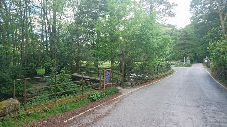
The Entrance to the Small Foot Bridge
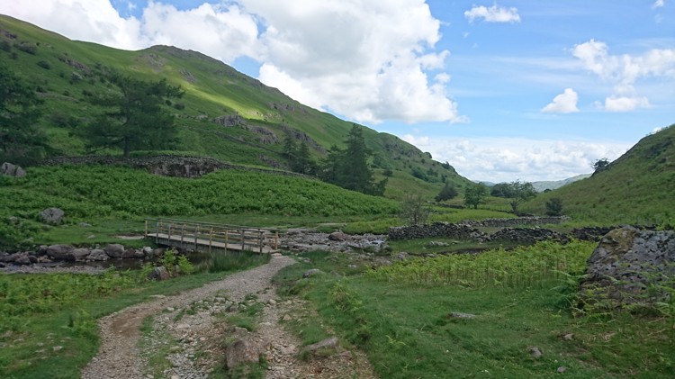
Turn left out of the gate onto Easedale Road. Follow the road past a number of buildings. You will also pass the entrance to a footpath on your left signposted for Langdale. You will eventually come to a small turning on the left that leads directly onto a footbridge, signposted for Easedale Tarn. Take this turning and go over the bridge. Children might like to hunt for trolls or play a game of pooh sticks.
Crossing the Beck
The Track through the Farmland
At the other side of the footbridge, there is a small wooded area and a clear path that leads you through it. Once through the wooded area there is another, smaller stone bridge to cross. After crossing this bridge follow the path that is straight ahead, and this leads you to a gate. Go through the gate and you will once more be on open farmland, with a large clear track for you to follow.
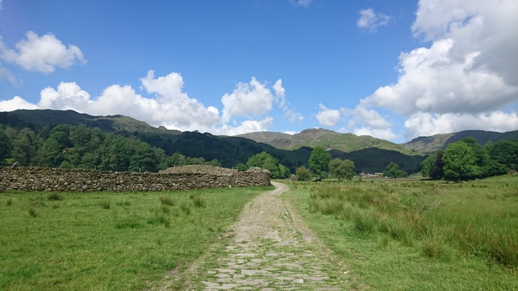
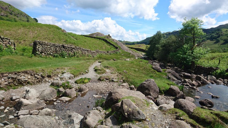
Following the Track
A Fork in the Track
The track follows a stone farm wall on the left through a field with the beck on your right. You will pass a stone bridge on your right, which again, is wonderful troll hunting territory. Continue past the bridge, and the field narrows, until eventually you are enclosed by the wall on your left and the beck on your right. Go past a gate on your left that leads onto another footpath and remain on the stone track.
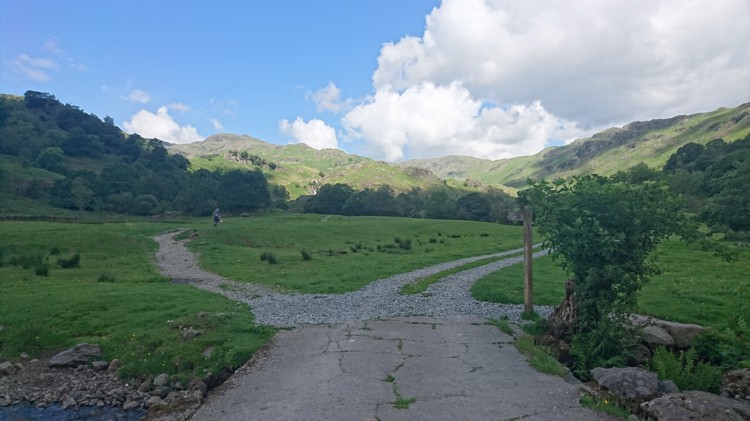
Just beyond this, the path leads into a more open area with a gate at the end. Go through the gate and over a flat stone bridge. At the end of this bridge, the path forks. Take the left hand fork, signposted for a public bridleway.
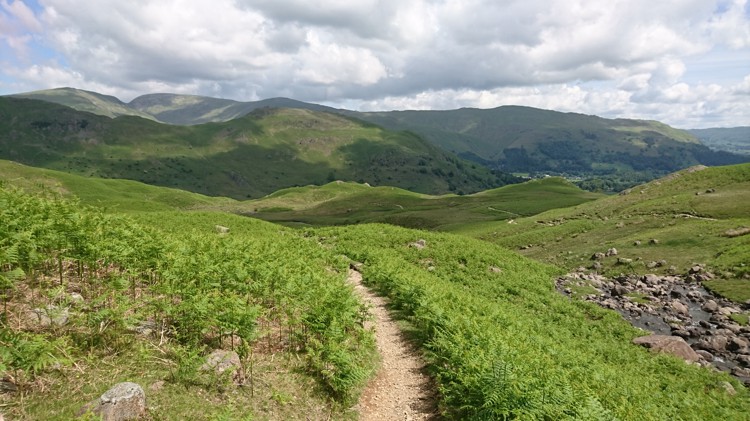
Sourmilk Gill
The Path with the Waterfall in View
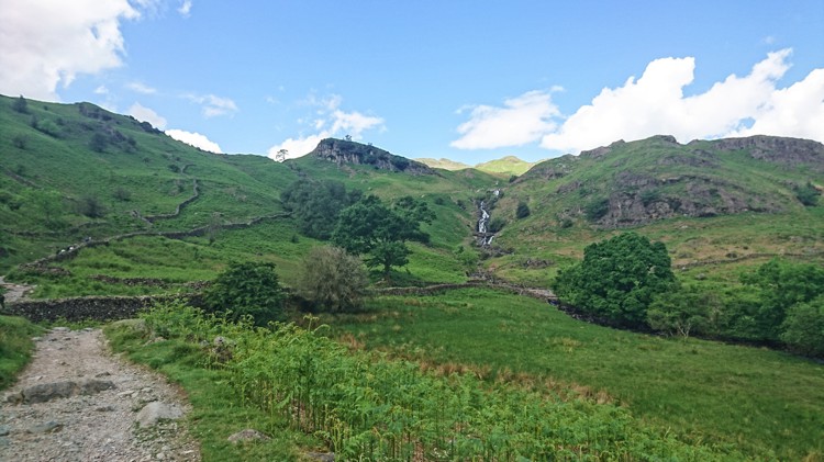
From this point, the path is very easy to follow, as it winds up the side of Sourmilk Gill. You will see the waterfall from a distance at first, and eventually the path joins its base, and winds up the side. At various points you can leave the path to get close to the water, either for paddling, or for swimming. This is a popular place for hardy outdoor swimmers, particularly where the waterfalls lead into deep pools at various points. As usual, young children should be closely supervised.
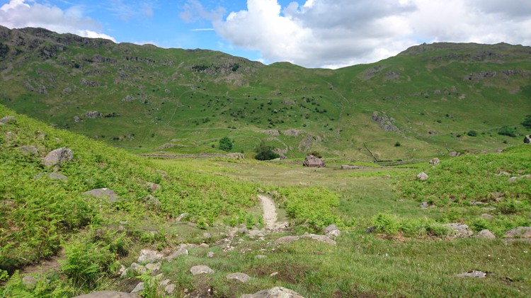
Approaching the Tarn
The Path at the Top of the Waterfall
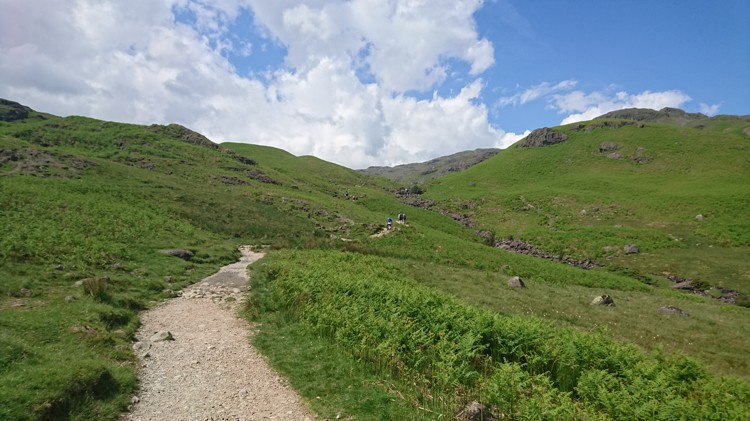
The path becomes rocky at times and younger children may need to engage in some scrambling to clamber over the larger rocks. At the top of the waterfall, the path levels off and you are now on the final stretch before you reach the tarn. The beck remains on your right hand side, and as you look ahead you will see the a v shaped ridge, with beck flowing from the middle of it. Just beyond this ridge lies the tarn.
Easedale Tarn
The Tarn as Seen from the Path
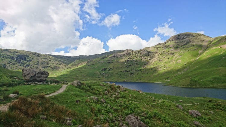
The path leads over the ridge, and the tarn is now in view. It winds down to the edge of the tarn, with plenty of spots here for a picnic. Again, this is a popular spot for outdoor swimmers, and you should be aware that the tarn is quite deep, and the bottom drops away quickly. Therefore any children paddling should be closely supervised. For an even longer walk, it is possible to walk the circumference of the tarn.
The Return Journey
Looking Back at the Stepping Stones over the Beck
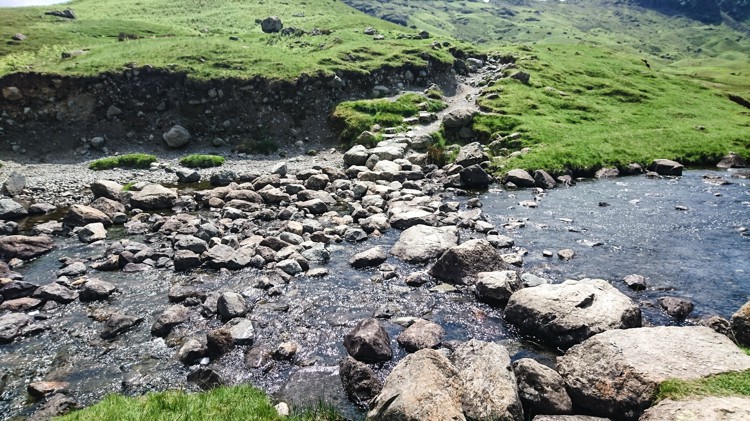
Once you have finished at the tarn, you have two choices. You can return via the route you ascended, which will make the walk about five miles in total. Alternatively, if you prefer a circular route, you can continue as per this guide. This next section is not suitable following periods of heavy rain, especially for children. To start this section, you need to cross over the beck at the eastern edge of the tarn (this is side that you arrived at, and is to the right of the path that you arrived by). There are stepping stones enabling you to do this.
Descending Along the Beck
The Path Descending Along the Beck
Once you have crossed over the stepping stones, take the path that leads off to your right. This path winds down the hill on the opposite side of the beck to that which you arrived by. For a while, the path closely follows the beck, before veering away to the left. At this point, the surrounding ground becomes boggy. There are stepping stones throughout, and it is possible to avoid the bog using these stones, but children may need assistance.
The Stone Wall and Boulder
The Stone Boulder and Wall in the Distance
Once you have passed through the boggy area, the path once again becomes firm. You will now see ahead of you a very large boulder with a stone wall behind it. As you approach the boulder, you will see that a helpful farmer has painted the word “Grasmere” and an arrow pointing to the left on it. As you reach the wall, follow the path to the left as the boulder suggests, rather than attempting to turn right down the valley in the direction of Grasmere. This is because you need to go around the field in order to join the main track.
Far Easedale Gill
The Bridge over Far Easedale Gill
The path leads along the wall and turns right. There are a couple of waymarkers that point the way, but if you are not sure, keep following the stone wall. At the bottom of the fell you will see Far Easedale Gill, and a footbridge enabling you to cross it. Cross over the bridge and turn right. This bridge has a bit of a wobble!
The Track Along Far Easedale Gill
The Track Along the Gill
The path now follows Far Easedale Gill through the valley. A short distance after the bridge, the path splits. You can take either fork, as they both join back together, but the right hand fork is easier to follow and gives a lovely view of another waterfall. After you have passed some fields the path becomes more enclosed, and rocky at times. Younger children may need support.
Returning to Grasmere
Easedale Road
Eventually the track becomes firmer and more level. You will pass some farm buildings, before eventually coming to a junction in the track. Left is signposted for Helm Crag, whilst straight on is signposted for Grasmere. Go straight on and you will come to a gate that you will need to go through. Once through the gate, the track ends at the road.
Turn left and you will now be back on Easedale Road, slightly further along from the point that you originally left it at the start of your walk. Continue along the road and you will eventually arrive back in Grasmere.